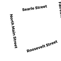
12 BARLOW ST (PALM)
Owner Information
TOPOR JUDITH M
12 BARLOW ST
PALMER, MA 01069


Property Details
12 BARLOW ST (PALM) is classified as a Single Family Residential (Cape cod).
The primary structure on this property was built in 1984. There are 2,928ft2 of built area within this property. There is 912ft2 of residential/living space within this property.
12 BARLOW ST (PALM) is valued at $191,800. The land is valued at $43,400 and the structures are valued at $140,400. There is an additional valuation of $8,000 on this property.
This property is in Zone TR. Confirm with local Zoning Board authorities to ensure there are no overlays or other easements on this property.
The most recent deed for 12 BARLOW ST (PALM) is recorded at the local registrar in Book 15515, Page 0339. 12 BARLOW ST (PALM) was last sold on Tuesday, November 22, 2005 for $0.
Assessment data from fiscal year 2022.
Flood Data
According to the FEMA National Flood Hazard Layer, this property does not appear to be in a flood zone. It may also be in an area not yet reviewed. Nonetheless, confirm this information prior to taking any action.
To view the flood hazards around this property, create a FEMA "Firmette" Map of the area around 12 BARLOW ST (PALM).
Broadband Internet Providers
| Provider | Type | Bandwidth (mbps) | |
|---|---|---|---|
| T-Mobile | Fixed Wireless | 25 | 3 |
| VSAT Systems, LLC. | Satellite | 2 | 1 |
| HughesNet | Satellite | 25 | 3 |
| GCI Communication Corp. | Satellite | 0 | 0 |
| Comcast | Cable | 1000 | 35 |
| Verizon New England Inc. | DSL | 7 | 0 |
| Viasat Inc | Satellite | 100 | 3 |
| Crown Castle Fiber | Fiber | 0 | 0 |
Broadband service provider data from December 2020.
Adjacent Properties
- 1670 N MAIN ST (PALM)
Developable Residential Land owned by CIL REALTY OF MA INC - 1673 N MAIN ST (PALM)
Single Family Residential owned by JACKSON DERICK - 10 BARLOW ST (PALM)
Single Family Residential owned by MALCOVSKY EMILY M - 30 ROOSEVELT ST (PALM)
Single Family Residential owned by ZEBROWSKI SANDRA A - 22-28 ROOSEVELT ST (PALM)
Apartments with Four to Eight Units owned by ADAMS CHRISTOPHER & PAUL